A Modern Approach to Fire Prevention Management
August 11, 2022
Geo-Enabled Weed Abatement Inspection Program

Fire Susceptibility in Rural California: At the Intersection of Open Space and the Built Environment
Fire Hazards in Merced County:
Fire hazards are abundant in Merced County due to the agro-centric economy in California’s San Joaquin Valley.
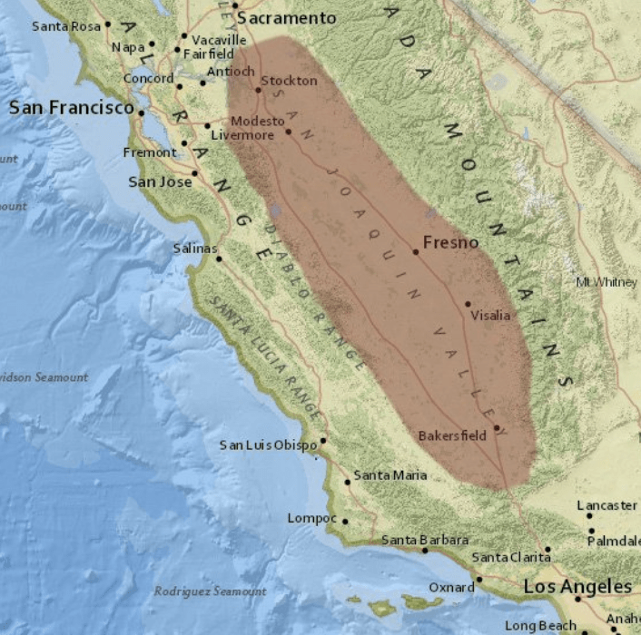

Grasslands, grazing lands, grain fields and other crops produce thousands of tons of dry fuels which burn readily in dry summer months.
This, coupled with high winds, multiple highway and rail systems, as well as recent drought conditions put Merced County at a higher risk for vegetation and debris fires.
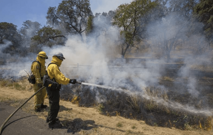
Fire Fighters Responding to Grassfire
Impacts Resulting from Non-Compliance:
Unfortunately, many of these fires have been known to spread into nearby structures and other outbuildings.
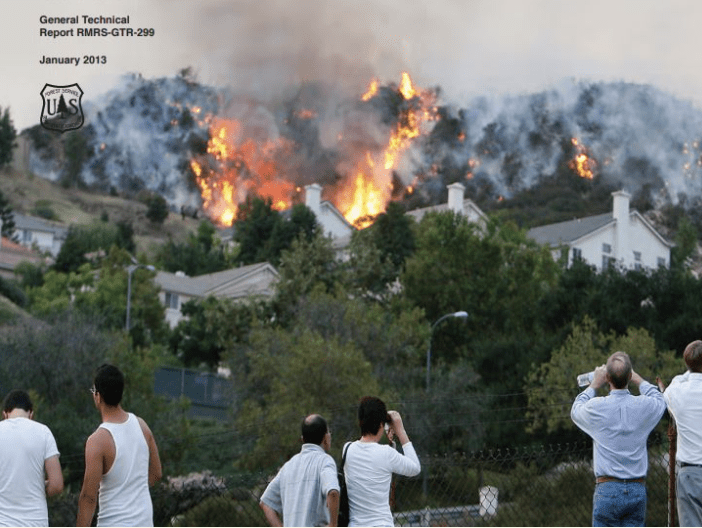
To prevent the spread of fire, property owners are expected to maintain a fire break around all buildings, structures, and property lines.
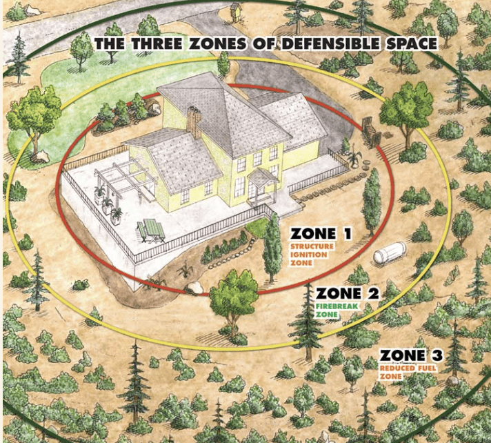
Defensible Space
Previous Business Practices:
Merced County Fire Department completes annual fire hazard inspections every spring, as many property owners overlook the inherent danger in not taking adequate precautions in properly mitigating for combustible organic material.

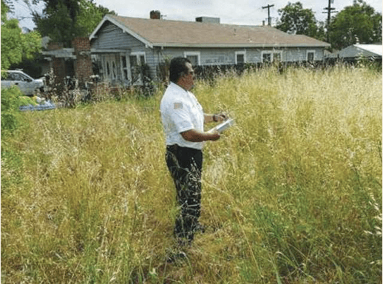
Previous paper based methods of collecting field data during these inspections has at times resulted in delays in notifying property owners of hazard violations which increase the potential for fire threats.

Paper-Based Data Collection
A GIS Solution:
In response to administering somewhat obsolete inspection practices, the Weed Abatement Inspection Modernization Project relies on GIS technology to collect field data used to notify property owners of potential hazard violations and to track abatement actions.
Mobile applications such as Esri’s Survey 123 and Field Maps provide the front end user interface that allow first responders to eletronically submit inspection information over the web.
ArcGIS Survey123: Product Overview

Get to Know ArcGIS Field Maps
Streamlining Administrative Processes with Feature Reports:
Administrative Staff previously conducted a more manual operation in converting written data from the field into an electronic based violation notification form that would be sent to property owners. This time intensive process often included additional research identifying property ownership information, maintaining status updates on whether actions were taken on violations, and in accounting for violations that were resolved.

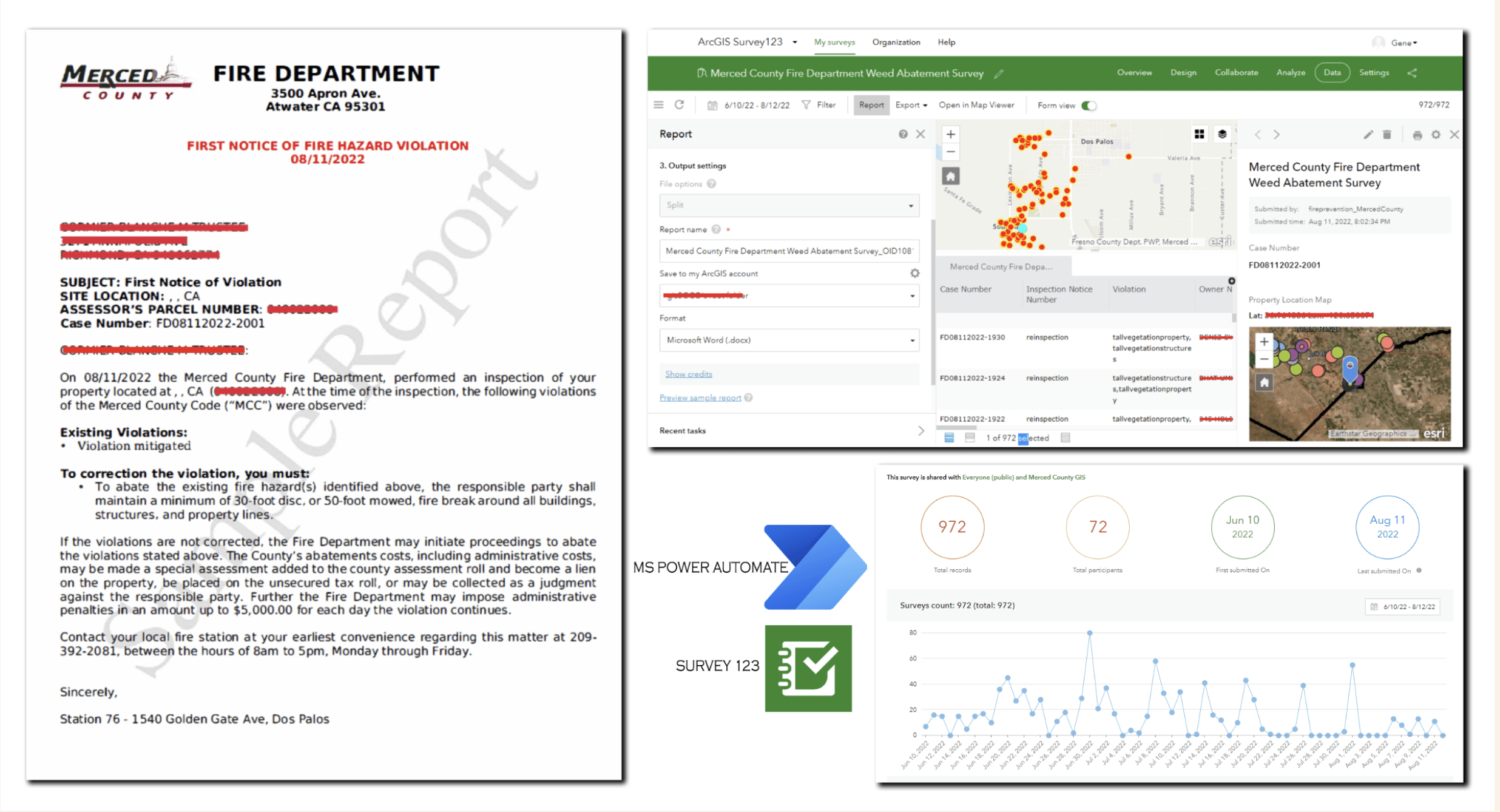
The modernization project now relies entirely on preconfigured documents using data captured in the field from the Survey 123 mobile app. Some of this data captured in the field is being pulled directly from ownership information in a web accessible GIS database updated by the Merced County Assessors Department. Pre-configured code violations used in the field applications ensure office staff are receiving accurate information from which to administer the notification process.
The property owner notification process relies on Survey 123’s Feature Report technology to automate the notification letter publishing process. This automated reporting functionality provides office staff with a seamless means to auto-populate forms that are ready to print with little to no manual data entry required.
ArcGIS Survey123: An Introduction to Reports
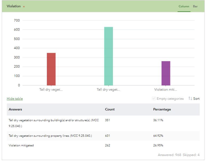
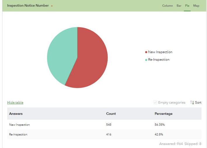
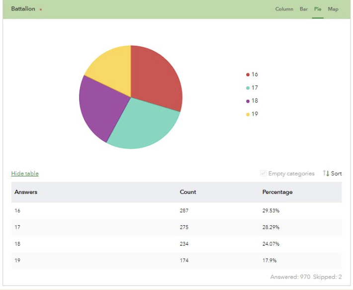
Survey 123’s desktop environment also provides office staff with analytic capabilities use to conduct several tasks such as identifying the type of violations inspected, those inspections that are new versus those in re-inspection status, and the number of inspections conducted by Battalion.
The GIS Web Pattern
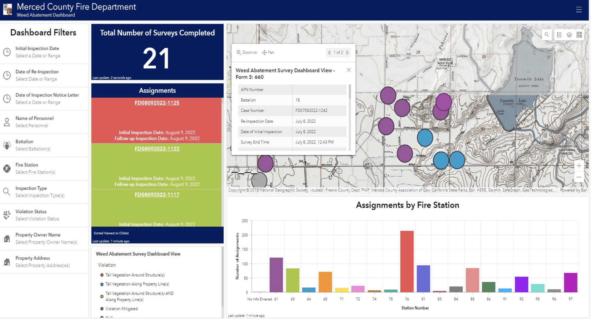
Utilizing Esri’s Web GIS architectural pattern to access data from the field, office staff also have immediate data from which to identify total case counts by date, violation status, violations occurring by battalion as well as several other data points.
VIDEO – Web GIS: Architectural Patterns & Practices
This data is showcased on a GIS enabled dashboard that has been configure for various types of analysis used in reporting statistical information about the program. This dashboard has been configured with decision makers in mind and is used to identify gaps in resource allocation, staff performance as well as concentrations of violation activities to name a few.

The entire weed abatement maintenance rests on the County’s ArcGIS Enterprise platform using Esri software . Esri is the leader in geospatial solutions and is well suited for local government use. The County’s on premises Enterprise environment takes advantage of locally managed server capabilities to deliver data maintained within a secure environment while also receiving data from the field. This capability allows the County to share data across the platform to both internal and external users. The desktop and mobile applications configured for this project rely on the enterprise environment to meet the needs of the Fire Department.

The Weed Abatement Inspection Modernization Program was collaborative effort between the Merced County Fire Department, The GIS Division of Merced County and the Sidwell Company who played an integral role in providing their expertise in configuring the GIS applications supporting the program.

Contacts:
Greg Padilla, Battalion Chief Merced County Fire Department Gregory.Padilla@fire.ca.gov 209-385-7311 Ext.4883
Gene Barrera, GIS Manager County of Merced Gene.Barrera@countyofmerced.com , 209-385-7311 Ext. 4358
Carissa Choong, Manager, Product Development The Sidwell Company CChoong@harriscomputer.com 630-659-1546
This case study is also posted by Esri: https://storymaps.arcgis.com/stories/cef09a7256af49b8848ef3739dfc60a3