
In 2007, the North Dakota Legislature passed House Bill 1303 requiring North Dakota Tax Directors to utilize the detailed soil survey for Agricultural Real Estate assessments by tax year 2010. This required counties to calculate areas of parcels and soils, and produce valuation schedules, property record reports, and soil maps that included land use with descriptors.
The Problem
At the time, many North Dakota counties had hand-drawn, hard copy parcel maps and old paper soil maps, making it frustrating to calculate farmland assessment values, and equally difficult to generate accurate values. Also problematic was the fact that the maps were drawn at different scales and had unreliable accuracy. The task of calculating soil areas within parcel boundaries and the assessment values that result from these calculations was time consuming and inconsistent.
The old manual methods of calculating farmland assessment were anything but accurate. Counting dots or square grids over a soils map was the method of choice for calculating the area of soil types within a parcel. More recently, methods and accuracy were perceived to have advanced with the use of a tracing planimeter. Calculations were totaled by hand on a “farm card” to show the total assessed value based on soil productivity.
 The Solution
 The Solution
In order to increase functionality, efficiencies, and ease of use, Sidwell has helped many jurisdictions, including several in North Dakota, to modernize their assessment valuation processes. The need for local government to have accurate and complete geospatial information is essential.
Sidwell has developed FARMS™, a GIS-based solution to support the process of farmland assessment.
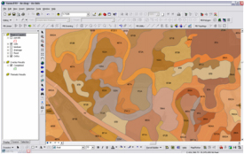 FARMS is specifically designed to perform agricultural real estate assessment, and has the ability to:
- Cross-reference assessed acreage to map acreage
- Report parcel, land use, and soil code errors
- Quickly update PI values
- Force adjustments of farmland assessment
- Use individual vs. weighted tract methods
- Generate assessments based on unique units of parcel, soil type, and land use
- Export data into any tax administration or CAMA system
Sidwell’s best of breed farmland assessment tools combine with the latest in Esri technology to offer a premier software solution for supporting the process of agricultural property assessment.
The use of GIS transforms the entire process into a fast, accurate, and consistent method of calculating farmland and soils type acreages for the purposes of assessment valuation. It is tailor-made for farmland assessment. GIS uses different types of digital maps, each representing various data, such as parcels, soils, and land-use. This information is brought together in one overlay format for easy analysis and validation.
The Process
- Countywide agricultural land use layer created by Sidwell, using most current digital orthophotography
- Sidwell interpreted the orthophotography to determine crop and non-crop areas.
- Additional non-crop categories determined, including drained, pasture, wet pasture, site, waste, roads, water, trees, etc.
- Each township was reviewed by client after completion, with edits forwarded to Sidwell
- Final data validation checks performed by Sidwell for GIS data layers
- Initial spatial overlay operation performed by Sidwell to generate acreage values for all agricultural properties
- All data and final calculations delivered to client for implementation
The Benefits
- Various data layers in one format
- Improved method and efficiency of farmland assessment calculations
- Eliminates inaccurate methods
- Easy data validation and modification
- More accurate information
- Integration of data
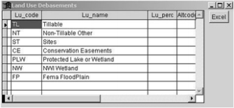 GIS, with its ability to bring various data layers together, enabling the user to report on data by individual parcel, has improved the method and efficiency of farmland assessment calculations. GIS relieves users of the old tedious method of hand calculation each time a parcel is created or modified. It also allows for easy data validation and/or modification to data that can then be recalculated throughout an organization’s agricultural parcel data. This provides better, more accurate information upon which to generate farmland assessment values, and adds new efficiencies and accuracies to the entire process.