Imagine you’re preparing agricultural land valuations. You’re forced to continuously switch between spreadsheets and manual maps, you feel overwhelmed and ultimately confused. It’s a process that is time-consuming, prone to errors, and stressful. Sound familiar?
What if you found a solution that simplified the entire workflow? One that was designed with assessors and GIS professionals in mind? Let us introduce you to FARMS; Farmland Assessment and Report Management System.
What is FARMS ?
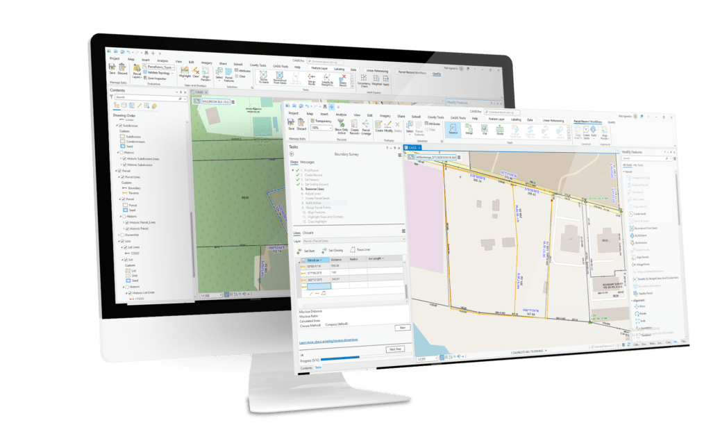
FARMS is a software solution that fully integrates within the ArcGIS Pro environment. It’s a simple way to conduct agricultural land assessments, helping to turn a once daunting task into a streamlined, accurate process.
Why Agricultural Land Valuation Is So Complex
Valuing agricultural land is a large task. Assessors across counties face a thread of common challenges, including:
- Reconciling discrepancies in acreage calculations.
- Creating maps to visualize data effectively.
- Generating detailed reports that align with soil productivity indexes.
These tasks often require multiple tools and platforms, increasing the likelihood of errors and slowing productivity
FARMS Puts The Power Of GIS In Your Hands
FARMS changes the game by bringing agricultural assessments into the GIS environment. With FARMS, you no longer need to switch between systems or rely on manual calculations. It’s a one-stop solution for accurate, efficient farmland valuation.
Why FARMS ?
With so many agricultural land assessment options, it can be difficult to identify the right software for your needs. But here’s why FARMS stands above the rest:
Efficiency in GIS
With FARMS, everything is performed within the ArcGIS desktop environment. From spatial analysis to reporting, there’s no need to switch between platforms or export data. FARMS allows the handling of your agricultural assessments without interrupting your existing workflow.
Accuracy
With FARMS, everything is performed within the ArcGIS desktop environment. From spatial analysis to reporting, there’s no need to switch between platforms or export data. FARMS allows the handling of your agricultural assessments without interrupting your existing workflow.
Integration
If you’re already using GIS, there’s no need for additional SaaS platforms or subscriptions. FARMS integrates completely with your existing ArcGIS tools, making adoption quick and easy – no need to learn a new system.
Practicality
GIS is already the heart of spatial data operations. FARMS builds on this foundation, eliminating redundancies and streamlining your workflow. Now you can handle everything from data collection to reporting all within the same system you already trust.
FARMS’ Spotlight Features
FARMS helps you get the job done better

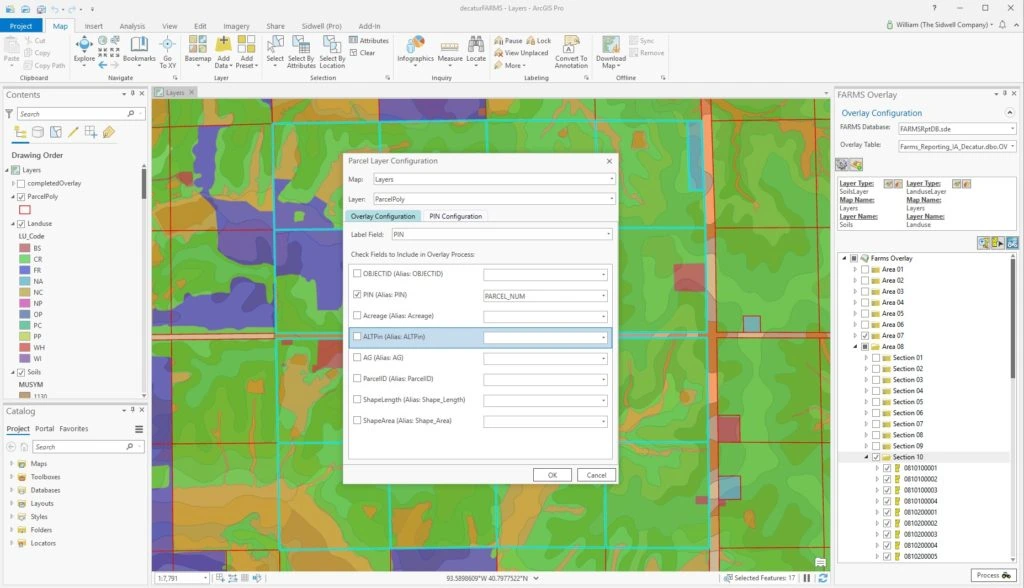
Custom Tolerance Settings
User-defined tolerances minimize acreage discrepancies.

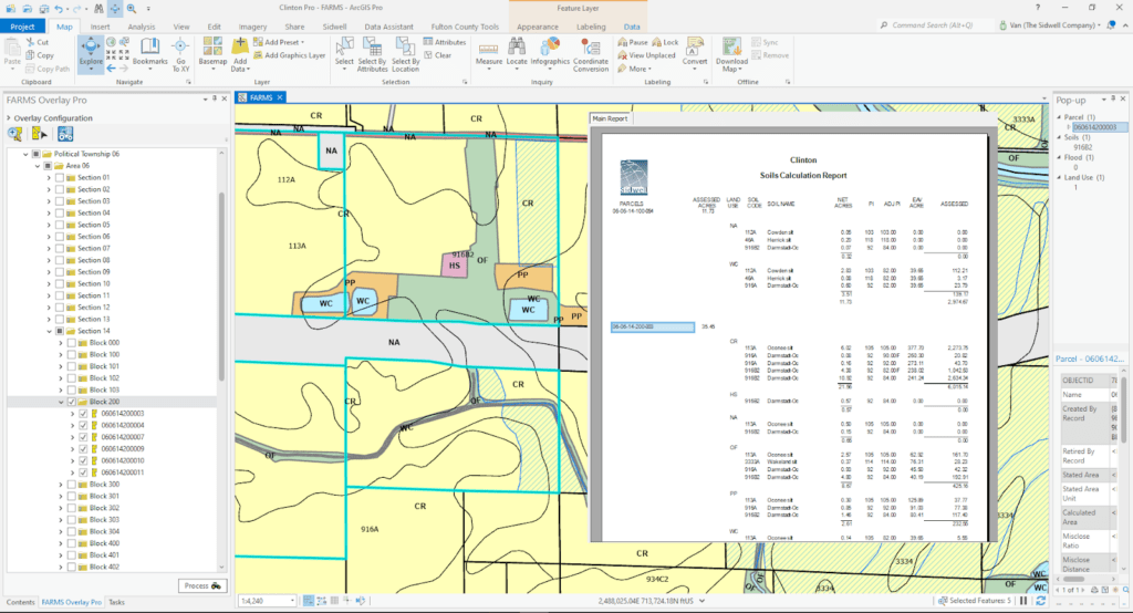
Thematic Maps
Create presentation-ready maps to visualize soil types and land uses.

Detailed Reports
Produce valuation reports with soil productivity indexes for accurate assessments.

Data Export Made Easy
With compatibility across platforms, you can easily export to CAMA or tax systems.
Transform Your Assessment Process With FARMS
The future of agricultural land valuation is here. Ready to see what FARMS can do for you ?