Legacy to Leading Edge
About Jefferson County
Jefferson County is the largest Alabama county with over 600,000 residents. Led by the Board of Equalization, Tax Assessor’s Office, and IT Services, specifically the GIS group, the county’s mission is to manage departments focusing on tax map modernization.
Challenge
Jefferson County faced challenges using an outdated tax application. From obsolete technology, specifically ARC/Info, to outdated scripting languages, the two decade old infrastructure was the source of compromised security and inaccurate parcel data. These issues had a ripple effect on public facing applications and trust in the county’s ability to provide reliable data.

“We have a parcel lookup app that has 1.4 million views that is public-facing. So the main emphasis was ensuring the tax system would be scalable and modernized to support moving forward,” said Joshua Chris, Enterprise GIS Manager. The county’s lack of up-to-date technology was interfering with a host of business operations.
Jefferson County was forced to deal with inaccurate data of nearly 320,000 parcels. Many parcels had unestablished tile corners and tile edges, with noticeable gaps and overlaps. To make matters more difficult, Jefferson County housed two independent divisions, Birmingham and Bessemer, each with autonomous Tax Assessor mapping departments. The Tax Assessor had to keep track of city boundaries and corporate limits, managing them in separate layers during annexations. On top of that, they were handling work from multiple years at the same time.

It became clear that the tax system needed an upgrade to make things more efficient. The main challenge was to replace outdated technology, fix security risks, and resolve data inconsistencies to create a modern and scalable tax system for Jefferson County.
Solution
To meet the needs of Jefferson County, Sidwell identified three solutions to meet their needs; Parcel Fabric, ArcGIS Pro and ArcGIS Enterprise. office.
Parcel Fabric
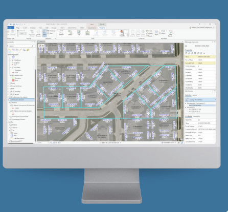
The ArcGIS Parcel Fabric provides an extensive framework for managing, editing, and sharing parcel data in both a multiuser and single-user environment. In the multiuser environment, the parcel fabric can be edited and maintained using a services-based architecture. This architecture lets users share the parcel fabric across desktop, mobile, and web, and different workflows can be enabled on different clients in the field and in the office.
ArcGIS Pro
ArcGIS Pro is a powerful desktop mapping tool to edit and manage parcel data. It allows users to explore, analyze, and create both 2D maps and 3D scenes. Users can also share their work online through ArcGIS Online or ArcGIS Enterprise.
ArcGIS Enterprise
ArcGIS Enterprise is the core system that powers mapping, data analysis, and management. It enables the us of ArcGIS Parcel Fabric and supports both Esri applications and custom tools. ArcGIS Enterprise works closely with ArcGIS Pro for mapping and seamlessly connects with ArcGIS Online for web-based GIS.
The Outcome
Modernizing Jefferson County’s Parcel Data
The Assessor’s Office partnered with Esri partner Sidwell to launch the first county-wide resurvey in 37 years. This project significantly reduced errors in parcel data, resulting in fewer public inquiries about inaccuracies.

To update parcel and lot boundaries, Sidwell took a modern approach, combining aerial imagery with newly surveyed section corners. They worked from original subdivision plats and recorded measurements (COGO attributes) while also cross-referencing existing surveys and county data to ensure everything lined up correctly.

Throughout the process, they focused on keeping key layers – like subdivision and corporate boundaries – accurate and aligned. The updated parcel fabric was delivered in phases and integrated into a geodatabase using the latest ArcGIS Pro technology. With this system, county staff can now manage parcel boundaries, annotations, and tax maps more efficiently. The data was loaded into an enterprise geodatabase, allowing for real-time collaborative editing across multiple locations. Plus, automated rules and workflows were put in place to enhance accuracy and minimize errors.
By upgrading from outdated technology to Esri’s modern parcel fabric model, Jefferson County significantly improved its data processing, making parcel information more reliable across departments. These enhancements went beyond the Assessor’s Office, helping refine Emergency Services Network (ESN) boundaries and supporting courts, municipalities, and other agencies in making better-informed decisions.
One standout example was the City of Birmingham, which leveraged the updated parcel data to refine its City Council boundaries. The success of this project fostered an ongoing partnership with Sidwell, including continued data maintenance, ArcGIS Pro training, and workflow improvements to keep Jefferson County’s GIS technology running smoothly.
“In the assessor’s office, our goal was to try to bring the county into the 21st century. This project was really helpful in getting that done.“
– John Powe, Chief Deputy Tax Assessor of Jefferson County