Websites like Google and Bing provide aerial imagery, but these images are not reliable for property assessment purposes. The available imagery may have been flown in leaf-on conditions, and/or the imagery is not on the same coordinate system as a County GIS system, which can make these data sets harder to use for your specific business needs. Many counties contract for their own orthophotography projects because their day-to-day office operations require images that are very accurate, current, and flown in leafoff conditions.
There are benefits gained from contracting new flights on a consistent basis. The imagery can be compared to previous years, potentially generating increased assessment revenue. It can also be used to easily identify buildings that are obstructed by vegetation on other imagery. “The clarity of our new aerials are amazing! Some of our parcels are heavily wooded, and newly built structures may be difficult to locate on a large parcel,” says Doug Bowerman, Assessor for Lawrence County, Missouri. “By comparing the older aerial photos to the new ones, we are able to locate these “hidden” structures.”
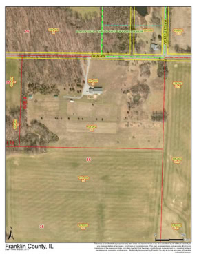
Some assessors are seeing tangible benefits for their County as well. According to Cindy Humm, Supervisor of Assessments for Franklin County, Illinois, “We used the new aerials to compare our assessment records to what was actually on each parcel. Any discrepancies were sent to each township assessor. The township assessors turned in $3,540,545 in new construction for the 2013 assessment year. That, of course, was the assessed value which means over $10,000,000 in value. I would say at the very least, 80% of that increase was due to the new aerial photos.” She goes on to say, “After the assessments were completed on the township assessor’s line, I personally went to the parcels that were not visited by the assessors. Most of those omitted assessments were in one particular township. The assessment added to the tax base was $4,242,050. That would be the equivalent to $12,726,150 of value. I feel comfortable in saying that 100% of that work was due to the new photos. We are planning to get new flights every other year, if our budget allows. In my opinion, this is the best tool to keep on top of new property that is available to a county of our size and resources.”
Over the past few years, the cost for orthophotography has reduced significantly due to technological advances and streamlined workflows, making it much more affordable. In fact, many counties are now able to afford flying ½ foot pixel orthophotography for the entire project area.
Orthophotography remains an important tool in the assessor’s toolkit. Current accurate, leaf-off imagery provides the best return on investment to truly see what improvements have been made on properties. Additionally, having reliable aerial imagery provides efficiencies for field staff by minimizing safety concerns and hard-to-access locations.
For over 50 years, Sidwell has provided orthophotography to local government agencies. We know that it is one of the most crucial components of a successful GIS. We work with each agency to determine their needs before we fly. The orthophotography is produced in-house at our Sidwell headquarters in St. Charles, Illinois. To learn more about how these services can benefit you, please contact your Sidwell representative.