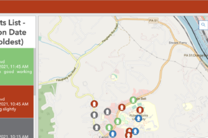
Sidwell developed a robust mobile Merced County GIS solution specifically for the Fire Department’s weed abatement program. This advanced mobile GIS application integrates the latest Esri technology, providing users with seamless access to Field Maps, Survey123, custom webhooks for efficient report generation, Web AppBuilder, and an ArcGIS Dashboard. This empowers on-site operations and streamlines administrative project management for the county.
Contact us to learn more!