
 Brian Baker, Regional Account Manager
Within the assessment community, a major “hot button” has been mineral rights issues and how they are managed. As stated by IAAO president and Cherokee County Kansas Appraiser, Kim Lauffer, “Some state statutes charge counties with taxing “severed minerals” if the current market indicates they have market value. There are a multitude of reasons that maintaining a GIS record of such ownerships would be highly valuable, such as: the ability to track actual ownership and to transmit this information quickly and inexpensively to users, i.e. governmental agencies, oil and gas companies, land leasing companies; tracking of “units” as assigned by producers; supporting documentation for division of interest ownership issues; and the ability to track and contact owners in natural disasters.”
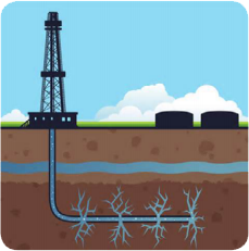
In many parts of the United States, the need for this vital information has risen at an alarming speed with the rapid expansion of fracking and horizontal drilling. Being prepared for a perfect storm by having this very important information mapped and available in a functioning GIS system is essential.
Specifically in Illinois, most leases are 40 acres or less, but with the new hydraulic fracturing and horizontal drilling, leases can be up to 640 acres. This presents a problem because it creates many more mineral interest owners that must be found and leased before drilling can actually occur. Oil and Gas committee chairman for the Illinois Chief County Assessor’s Organization, Mark Becker, stated, “During the recent rush to lease the county’s mineral owners, our GIS system was the first place the oil land manager looked for data on who owned the minerals. Without that information, we would not have been able to handle the multitude of people that flooded our office.”
 One of the things learned during the southern Illinois boom was that if you can provide the information in a timely fashion, the mining companies will pay for it. In Hamilton County, Illinois, the County Clerk was able to scan and put the recording record online, including deeds and assignments, through a subscription service. The County Assessor has signed a contract to have his GIS information hosted with our Portico solution, so his information will also be available online. Both of these services allow the customer to research information from their home location, rather than traveling many miles to the county.
In the ‘90’s, Hamilton County received approximately 7,000 acres of coal rights from a company that no longer wanted to be in the coal mining business. By using GIS and mapping the location of those parcels, the county was able to market and entice companies to start a new coal mine. The same principals now apply with mapping of oil interests. GIS is being used to map the location of these wells, along with managing valuable asset information which will help with leasing activities. One prime example occurs with zoning. The proximity of the well to a residential structure can be determined and a decision can be made whether to allow the drilling or not.
Most counties do not currently have all mineral rights mapped in their GIS. Going forward, as the need to more efficiently extract these assets becomes critical to the local, state, and national economies, it is essential for these mineral rights to be readily accessible and accurate. GIS is the perfect solution.